Crawford land in Pettis County, Missouri
Last updated May 24, 2004
Photos taken during trip by Nancy, Sharon, and Jim on May 12, 2004

Land Patents, Deeds, Leases, and Mortgages
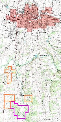
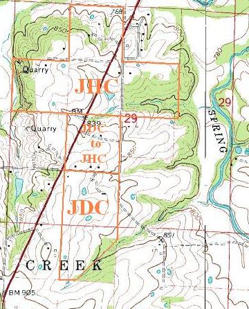
The USGS map on the left shows the relationship of Sedalia to the Crawford lands, which are outlined in orange, and the Bourn lands, which are outlined in purple. Note that not all Crawford lands are shown. The USGS map on the right shows sections 29 and 32, township 45N, range 21W, which includes land owned by JHC and JDC. The middle square was sold by JDC to JHC in 1865.
The following USGS map shows sections 4, 5, 8, and 9, township 44N, range 21W,
which includes the Bourn, JEC, and JHC farms. The colored boundaries are only approximations.
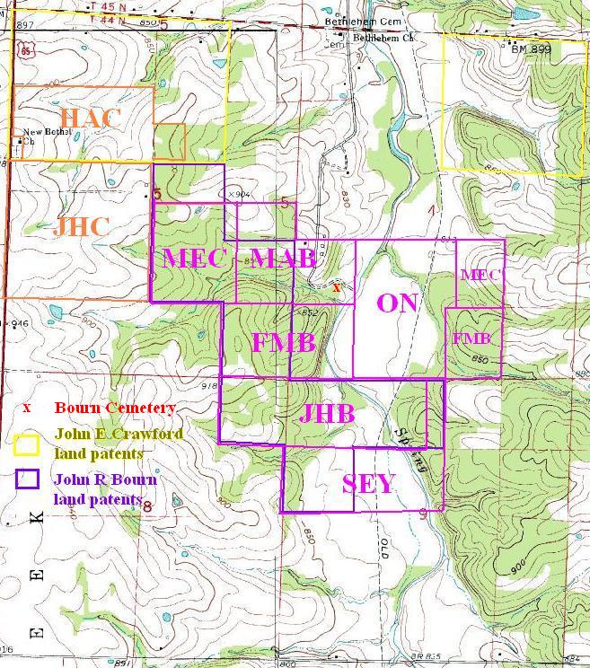
Note the following:
1. The John E Crawford and John R Bourn land patents account for only half of
the land these two eventually owned. In fact, their eventual homes were on
land acquired after the land patents.
2. The orange 'JHC' square was bought by JHC in 1866, leased and mortgaged in
1873, and sold in 1876 to HAC (with JHC retaining a mortgage on the property),
at the same time that JEC sold HAC the other orange 'HAC' land. So in 1876,
HAC owned all of the orange land. HAC then sold 2 acres in 1877 to the M. E.
Church (now the New Bethel Church), and in 1878 sold all of the rest of the
land to JDC, who immediately sold the 'JHC' square back to HAC's wife Nannie.
Two years later in 1880, it was sold to brother-in-law James J. Ferguson.
3. The light purple rectangles taken as a whole show the extent of the Bourn
Farm in 1876 when John R Bourn died. The land was divided into 6 shares ranging
from 90 to 120 acres, and sold for $1000. each to his widow and five children.
The farmhouse was probably one of the two black squares by the 'B' in the 'MAB'
parcel. Margaret E. Crawford sold her share in 1880 to her brother Fred (who
at the time was living in Montana).
This info is incomplete and needs more research at the County Court
House. In particular, we need to find when JEC and JRB bought all of the
land they did not patent, and to find when all of this land was sold to
non-relatives.