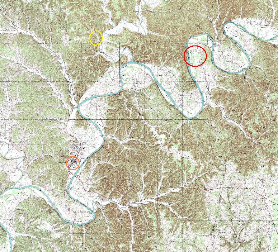
Map showing the location of JOHN CRAWFORD's land in Cumberland Co., Kentucky
-------------------------------------------------From the Cumberland County Survey Book A page 84 [in left margin:] survey 1799 Oct 20th [in main body on right:] John Crawford, as. of Joseph McCormick, as. of John Wright where 200 acre of second rate land, by virtue of a certificate for settlement No. 1151. In Green County. Lying on the south side of Cumberland river. Beginning at a beech tree mar- ked J.W. running thence up the river, binding therein; thence off from the river and off from the beginning for quantity including his improvement. -------------------------------------------------
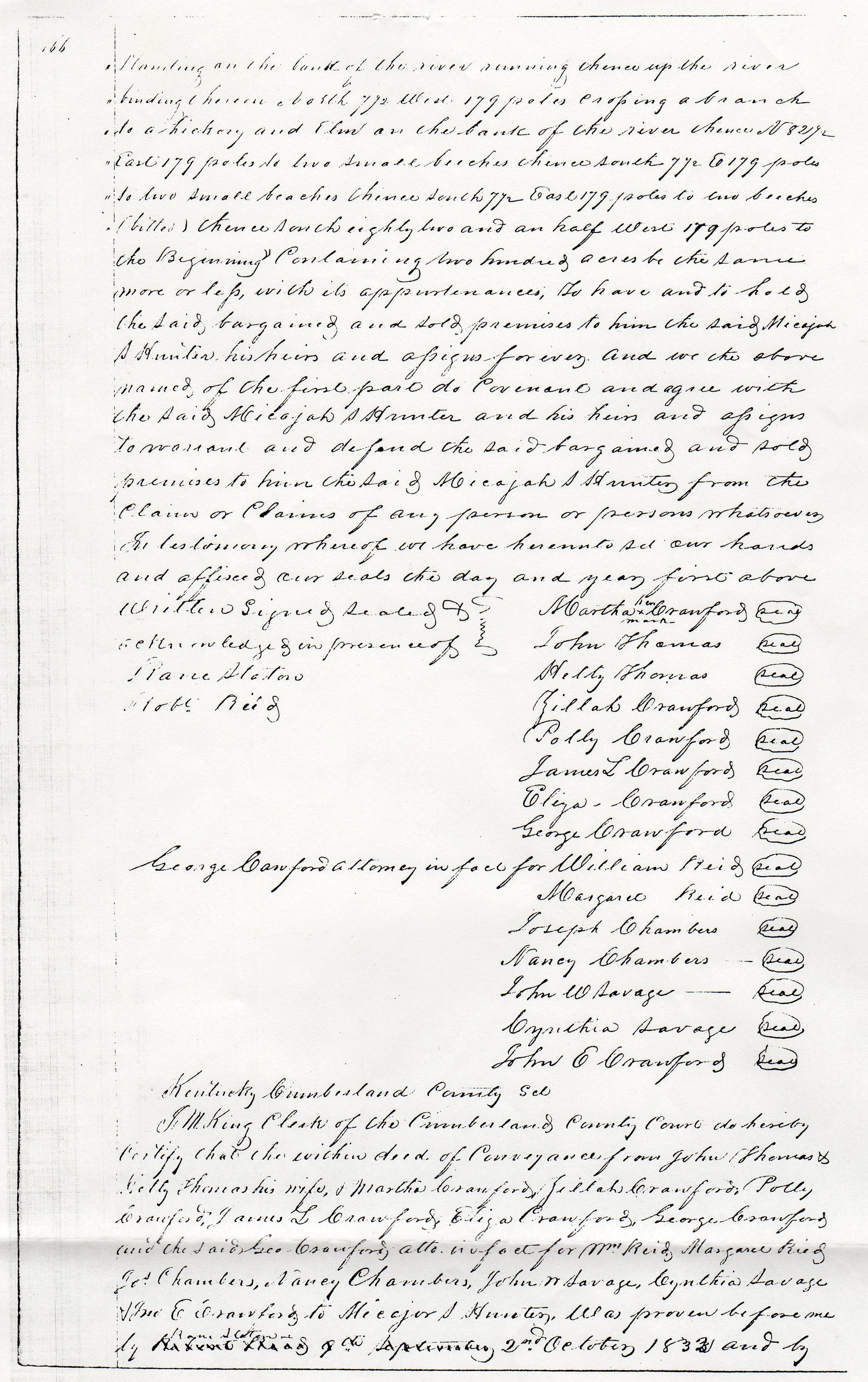
From the Cumberland County Deeds Book H page 165: This indenture made this 22nd day of September in the year of our Lord one thousand eight hundred and thirty two Between Martha Crawford, John Thomas & Hetty Thomas his wife, and Zillah Crawford, Polly Crawford, James L. Crawford and Eliza Crawford of the County of Cumberland & State of Kentucky and George Crawford, John E. Crawford, William Reid and Peggy Reid Joseph Chambers and Nancy Chambers & John M. Savage and Cynthia Savage of the County of Cooper and State of Missouri of the one part and Micajah S. Hunter of the County of Cumberland and State of Kentucky aforesaid of the other part. Witnesseth. That the said Martha Crawford and all the others above named of the first part for due con- sideration of the sum of one thousand dollars to us in ?? ?? the receipt whereof we hereby acknowledge have granted, bargained and sold, and by these presents do grant bargain and sell unto the said Micajah S. Hunter, his heirs and assigns forever a certain tract or parcel of land lying and being in Cumberland County and State of Kentucky aforesaid in the Irish Bottom on Cumberland River bounded as follows towit "Beginning at a beech tree marked J.W. standing on the bank of the river running thence up the river binding therein North 7 1/2 West 179 poles crossing a branch of a hickory and then on the bank of the river thence N 82 1/2 East 179 poles to two small beeches thence south 7 1/2 E 179 poles to two small beeches thence south 7 1/2 East 179 poles two beeches (killed??) thence south eighty two and an half West 179 poles to the Beginning" Containing two hundred acres be the same more or less, with its appurtenances, to have and to hold the said, bargained and sold premises to him the said Micajah S. Hunter his heirs and assigns forever and we the above named, of the first part do covenent and agree with the said Micajah S Hunter and his heirs and assigns to warrant and defend the said bargained and sold premises to him the said Micajah S. Hunter from the claim or claims of any person or persons whatsoever. In testimony whereof we have hereunto set our hands and affixed our seals this day and year first above. her Written signed sealed & Martha x Crawford (seal) acknowledged in presence of mark Rane Staton John Thomas (seal) Robt Reid Hetty Thomas (seal) Zillah Crawford (seal) Polly Crawford (seal) James L Crawford (seal) Eliza Crawford (seal) George Crawford (seal) George Crawford attorney in fact for William Reid (seal) Margaret Reid (seal) Joseph Chambers (seal) Nancy Chambers (seal) John W. Savage (seal) Cynthia Savage (seal) John E Crawford (seal) Kentucky Cumberland County ?? I.M. King Clerk of the Cumberland County Court do hereby certify that the within deed of Conveyance from John Thomas & Ketty Thomas his wife, & Marth Crawford, Zillah Crawford, Polly Crawford, James L Crawford, Eliza Crawford, George Crawford and the said Geo Crawford, atto. in fact for Wm Reid, Margaret Reid Jos Chambers, Nancy Chambers, John W. Savage, Cynthia Savage Jme E Crawford to Micajah S Hunter was proven before me by xxxxxxx xxxx xxx xxxxxxx 2nd October 1833 and by Robert Reid 9th September 1833. I ordered to record, and the same is timely entered of record in my said office in deed book H page 165 Given ?? my hand this 23rd day of November 1833 M King ------------------------------------------------------ From the Cumberland County Survey Book B page 386
[in left margin:] Fees $5, 39 2/3 [in main body on right:] According to an order of the Cumberland Circuit Court April Fourth 1844. Mary Hopkins Plaintiff and Betsy Keeton, Defendent, I proceeded on the 10th of October 1844 in company with Ewen Keeton, who produced a plan(?) cut in the name of John Crawford for 100 acres, bearing date the 5th day of January 1815, surveyed October 21st 1806 to lay off the land in displute, in the following manner viz: I commenced 20 poles due north from the beginning corner of a Hopkins' 400 acre survey, no corner stand- ing, but said to be the beginning corner of said survey; thence N. 42 degrees W 100 poles to an elm. From this line 60 poles to an elm which down and said by William Ketchen, who was one of the original chainmen, to be the corner. The tree is somewhat decayed, but I think I distin- ctly saw axe marks on it; thence N. 81 degrees W. 45 poles to a beech, not found, the land being cleared; thence N. 60 degrees W. 84 poles to a white walnut, which is down and partly decayed, I sup- posed it to be the corner in asmuch as my course and distance took me to it, the balance of the lines I platted by the consent of Keeton. The solid lines represent the Crawford 100 acre survey, and the dotted lines Arthur Hopkins 400 acres. The triangle A. F. G., is 28 acres contained in Hopkins' Patent [] represents Keeton's house. William Fletcher, Josiah Ward, } C.C. J. M. Baker, S.C.C. ?? ?? and duly sworn ------------------------------------------------- From the Cumberland County Deeds Book B page 182: [Note, Peytan Harrison & wife sold 350 acres where he lived North of Cumberland River to Francis Emerson in 1811. Francis Emerson esq. proprietor of Burkesville sold several properties in 1816 & later.]
[in left margin:] deed delivered to Judge John Crawford on the 13th day of January 1813 ??? Milton King D?? [in main body on right:] This Indenture made entered into this 30th day of December 1811 between James W. Taylor & Phebo Taylor his wife of the county of Cumberland and state of Kentucky of the one part and Francis Emerson John Crawford and Peyton Harrison all of the County and State aforesaid of the other part witnesseth that the aforesaid James W. Taylor and Phebo his wife for a full consideration to them in hand paid by the aforesaid Francis John & Peyton the receipt whereof is hereby acknowledged have bargained sold aligned and confirmed and by their presents they do bargain sell align and confirm unto the aforesaid Francis Emerson John Crawford and Peyton Harrison thus their heirs and assigns forever a Certain tract or parcel of land situated lying and being in the County of Cumberland and State aforesaid & lying within the boundary of the town of Burkeville and whereon part of this building of the Rope walk near Burkeville now stand it being part of lot No 146 in the plan of said Town of Burkeville and part of a fractional lot thereunto adjoinging on the upper a N. & East side of the aforesaid lot. Beginning at the S.W. corner of lot No 146 at the point of Junction between main Cross Street in the plan of the aforesaid Town and the lower Street upon the river known in the Trustees Establishment and name of Streets in the aforesaid Town by Water Street Thence N. 57 W. 4 poles to a stake Thence at right angles 13 po. and five feet to the line of ?? as the town boundary thence S 30 E. along the said line of Town Boundary 4 poles and 13 feet thence to the beginning containing one quarter of an acre ??? eight poles together with all the appurtenences thereunto belonging or in any wise appertaining to have and to hold the aforesaid land unto the said Francis Emerson John Crawford and Peyton Harrison their heirs and assigns forever free from the claim or claims of the aforesaid James W Taylor and Phebo his wife their heirs and assigns forever and also the said James W Taylor the aforesaid promises unto the parties aforesaid their heirs and assigns doth forever warrant and defend against the claim or claims of all and every person whatever. In testimony of which the said James W Taylor and Phebo his wife have hereunto set their hands and seals this day and date above written. James W. Taylor (seal) Phebe Taylor (seal)